Tettegouche State Park
On last Saturday, October 30th, my friend Aaron, my wife Autumn, and I went on a little day trip to the North Shore. The plan was to hike a six or seven mile loop in the Tettegouche State Park, home of the tallest waterfall completely within the state.
We got up early and were on the road by 6:05 in Aaron’s Subaru munching on Autumn’s cinnamon rolls. It was about a 3 ½ hour drive with only two major highpoints. First, the descent into Duluth was perfectly timed with the rising of the sun. We drove in as the town was transformed from its slumber into a bustling port. The factories and shipyards came to life and the marshes and islands were lit on fire by the sun as it filtered through magenta striations of clouds. It was the most picturesque sunrise I’ve seen for a long, long time.
The other drive highlight was when, about 10 miles from our destination, a bird suddenly flew up off the side of the rode as we rounded a corner on the sinuous coastal highway. It never had a chance—it came out of the bush and never saw us coming at 70 miles per hour. Generally this would be pretty gruesome, but for some reason the large bird deflected off the front corner of the car intact as if it was catapulted. It flew 15 feet straight up into the air and over the side of the cliff and then fell the 100 feet down to the waters of Lake Superior. It was super bizarre.
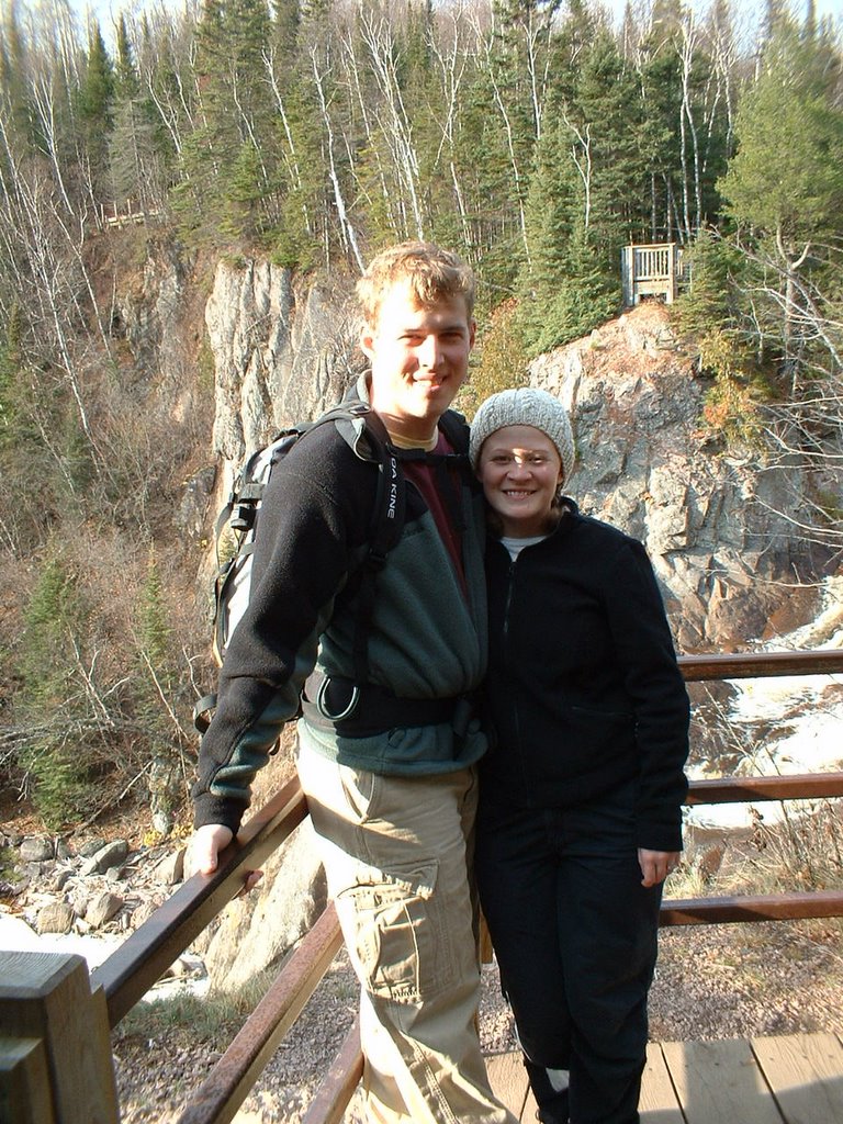
The park entrance also doubles as a turnoff for a rest stop. We pulled up to the ranger station and unfolded ourselves from the car and tumbled in to look over maps, use the restrooms, and talk over our hiking plans with the ranger. He recommended a loop to us and marked it on a trail map that he gave to us. We paid the $7 that gained us access to the trailhead another mile down the road. At 9:30, we parked the car, filled up our backpacks, and pulled on our boots.
We walked a quarter mile down from the trailhead to a small campground that was still thawing out from the morning’s frost and found a small track at the back of a campsite leading to a larger trail that allowed us to descend to the top of the falls. The park service had built observation decks with wonderful panoramas of the falls. We crossed the river above the falls on a swaying suspension bridge and walked down over 100 wooden steps to the bottom of the falls.
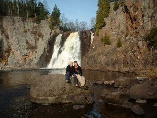
The bottom of the falls was incredible. If it wasn’t the last weekend in October I would definitely have been swimming, maybe cliff diving. We took a few pictures then climbed back up to the bridge. We bounced across the bridge and then began our hike in earnest.
We hiked on the Superior Hiking Trail for a few miles taking advantage of every overlook. Most of the leaves were off the trees leaving the forest’s floor scattered with a golden orange carpet of leaves. We stopped for lunch on a dome of rock overlooking a river valley with Mt. Trudee in the distance. Beyond Mt. Trudee was Lake Superior, distinguishable only by the glint of the sun on the water. Otherwise the sky and the water melted together in a hazy gray filling the entire view beyond the horizon of shoreline.
The fallen leaves completely covered the ground. If we had strayed a 100 yards from the trail we would have had a hard time finding it again. Trails are obvious because a patch of dirt running through a gap in the trees is easy to follow, but gaps in the trees were everywhere because of the fallen leaves and the path was obliterated. We had hike maybe three miles when we stopped for lunch. Autumn packed a delicious combination of sandwiches, cookies, and fruits for lunch and Aaron supplied pistachio nuts. We absorbed the sun as it tried to burn through a thin layer of gray clouds.
Two guys broke through the edge of the clearing taking us by surprise since they were the first people we’d shared the trail with all day. We hiked down from the clearing and around Mic Mac Lake to a group of four rustic log cabins accessible only by foot in the summer and skis or snowshoes in the winter.
The cabins shared the clearing with an outhouse and a hand-cranked pump. There was a lodge and a boat dock for canoes as wells as a massive stack of cut firewood awaiting future guests. We used the “facilities,” refilled our water bottles, and set out on the second half of the hike.
The trail followed along the marshy edge of the lake. We traversed wooden platforms spanning hundreds of feet of mucky reeds with gaps of clear water running between. The open patches of water were crystal clear and you could seed to the bottom often 10 feet down. We made our way over to Nipisiquit Lake cruising around its western then northern shores and up to another stunning vista on Papasay Ridge looking to the north. We could see probably 15 miles and the only thing breaking the wildness was a single logging road and two small cabins only noticeable because of the plumes of smoke ascending into the already smoky gray sky.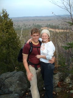
Each of the trail intersections was marked with a letter. The letters corresponded with notations on our maps so we could easily track the direction we needed to go. We arrived at an intersection marked “D” and turned to follow the trail to intersection “B,” which would lead to “A,” which was the trailhead. After hiking for 20 minutes we arrived at intersection “C.” Even though the trails were clearly marked, they must have been marked wrong. We were at the totally wrong spot. We weren’t really lost because the map showed our exact location, we just weren’t where we wanted to be.
Our option then was to hike back to the car along the trail we had already traveled on, or loop around to the car along another route. We chose to hike the trail we hadn’t been on yet. What should have been a short walk from intersection “D” to “B” added another hour and probably 2 miles to our trip. The loop around turned into a cross-country ski track, neatly groomed but quite mucky because of the wet weather.
We arrived at the car at half past three and changed out of our hiking garb, snacked on some leftovers, and laughed at our mistake. We settled into the car for our drive home, tired but satisfied, looking forward to our layover at the lighthouse and then dinner in Duluth before heading home to the Twin Cities…
posted by Eddy Zakes at 4:43 PM
3 comments
![]()
![]()

